Smart CAD

Smart CAD

Smart CAD

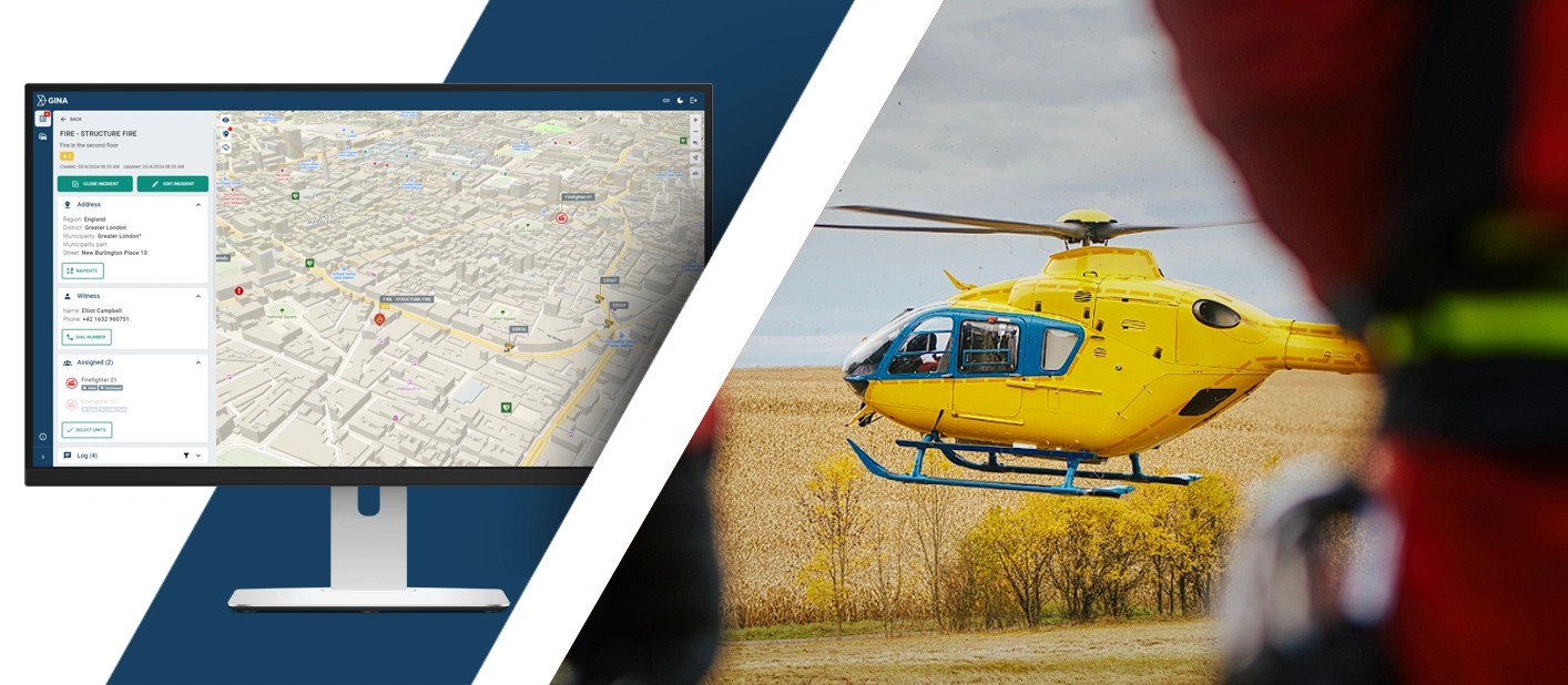
Increase your operational efficiency with intuitive software for rapid unit dispatching and incident management.

Trusted by lifesavers
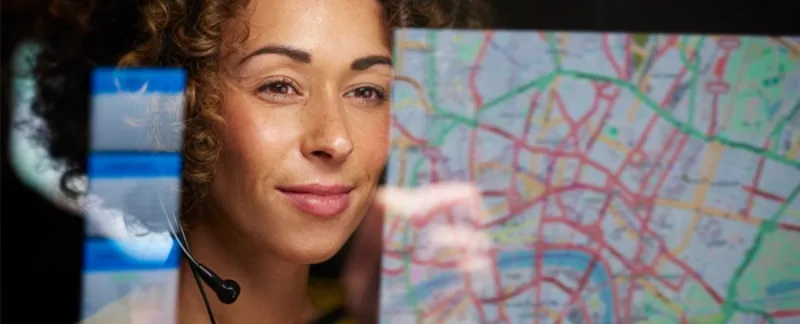
Streamlined dispatching

Streamlined dispatching

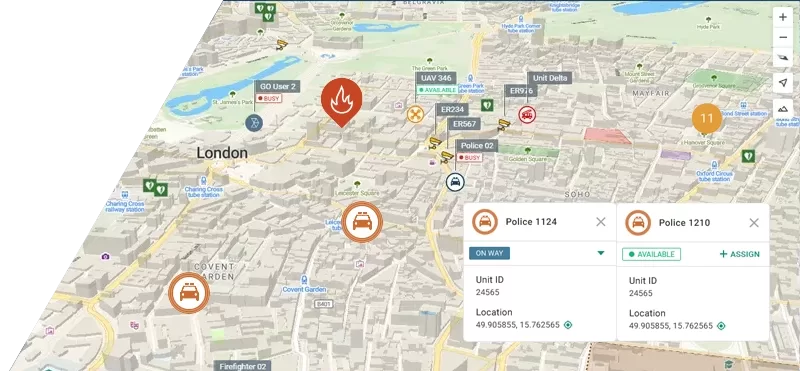
Simplify emergency call handling, units dispatching, and field communication. Smart CAD allows you to modernize dispatching workflow, automate day-to-day tasks, and ultimately achieve faster and more precise incident management.
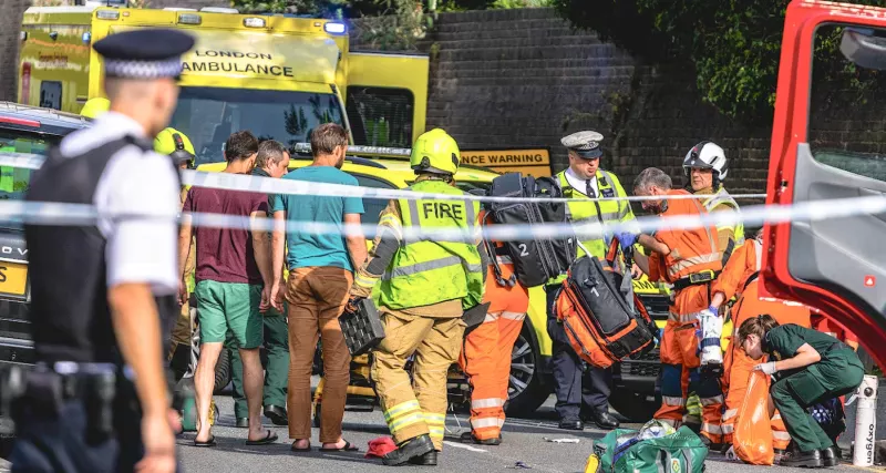
Enhanced field operations

Enhanced field operations

Access critical incident information in real-time, benefit from an intuitive navigation system, and maintain seamless communication with other field units. Smart CAD provides all the field staff needs for effective incident resolution.
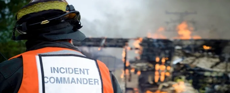
Clarity in command

Clarity in command

Smart CAD allows commanders to make split-second decisions with confidence. Based on actionable insights, latest updates on the incident, unit and resource availability and location, commanders can coordinate their field operations with speed and precision.

See why your peers choose Smart CAD

Sygic

Sygic

Partnering with solution providers, such as GINA, who create products that truly answer the needs of people and communities has been pretty amazing. Seeing how technology makes a difference in the real world is why we do what we do. And the results speak for themselves.

Katerina Cipakova
Katerina Cipakova Head of Sales Sygic
Fire Rescue Service of the Czech Republic

Fire Rescue Service of the Czech Republic

GINA significantly improves the efficiency of both routine and special operations, reduces arrival time, provides real-time information support, and increases the level of cooperation among all responding units. Thanks to technology we can react flexibly to altering situations in the field.

David Jirous
David Jirous The head of Operational and Information Centre Fire Rescue Service of the Czech Republic
Czech Red Cross

Czech Red Cross

Many of our members are volunteers who go out from their homes to the scene. At a time like this, it’s great to have an app that lets you see on a map how people are converging on the scene. You can then coordinate much better, for example, by talking to drivers.

Radim Dongres
Radim Dongres Deputy commander of the Humanitarian Unit Czech Red Cross
GM Risk Group

GM Risk Group

We have been working with GINA for a few years now and have found the software solutions to be a functional tool for our teams on the ground, plus a value add to our clients through our increased service capabilities. GINA provides our team and clients with high-level situational awareness by allowing us to tailor how we integrate, manage and share intelligence that is relevant to our teams and task objectives.

Liam Ryan
Liam Ryan CEO GM Risk Group
Alpha 6 Canada

Alpha 6 Canada

I was looking for a solution that would handle tracking as well as incident command and I found that in GINA. We can send messages, set up geofences, track our assets and it has good app that goes with it for the smartphone for our clients. GINA provides a lot of things for us. It brings a lot of things together – the tracking, the messaging and then the reporting.

Josh Baquie
Josh Baquie Director Operations at Alpha 6 Tactical Solutions
G2S Group

G2S Group

GINA has been our partner for the past two years in creating and implementing new and tailored systems for our Security company. We are also a business partner for them in the Horn of Africa region as both Facilitator and Reseller for GINA Software in Public Safety, Defense and Security, and Oil and Gas. They are reliable, thorough, smart, available, excellent communicators, and friendly! As a Partner of GINA’s solutions, we’ve obtained a broad positive reception, and allows us to meet the clients‘ requirements successfully.

ABDISHAKUR Hassan-kayd
ABDISHAKUR Hassan-kayd Co-founder G2S Group

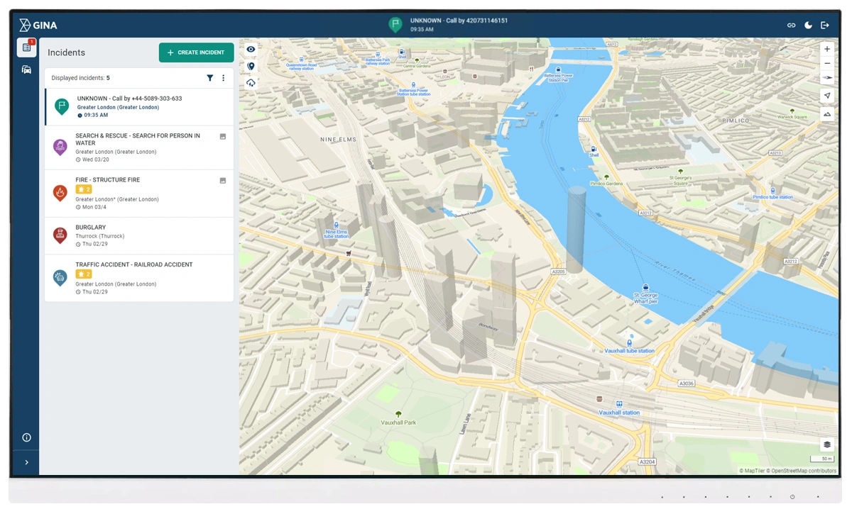
Calltaker

Streamline call taking, receive alerts from IoT devices and automate routine tasks.
Calltaker

Case management

Enable simple incident creation and allow editing at any time, including alerts for mobile users for real-time updates.

Telephony integration

Efficiently combine ANI for caller ID, ALI for precise location tracking, and 3rd-party recording integration.

Call log

View previous calls from the same number to identify potential abuse of the emergency line.
Calltaker

Dispatcher

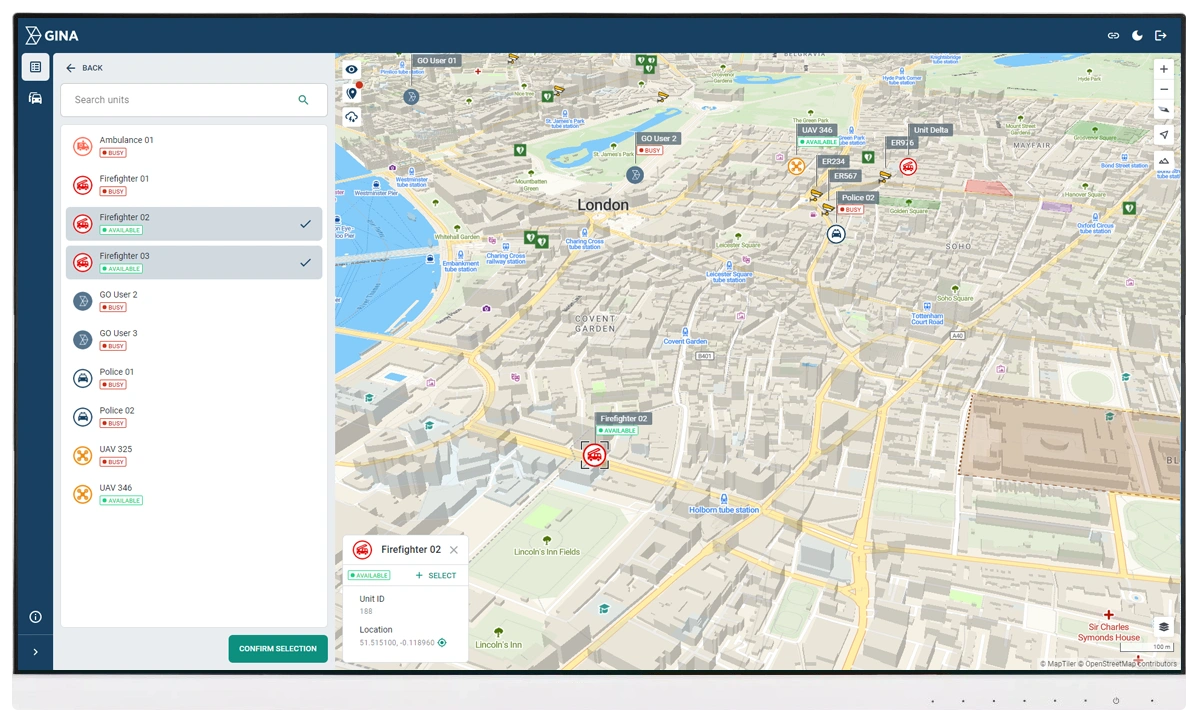
Efficiently dispatch units while knowing everything about the emergency situation.
Dispatcher

Resource management

Select and deploy units swiftly using machine-learning algorithms to suggest units for the quickest emergency response.

Situational awareness

Gain instant visual awareness with real-time location tracking, unit statuses, live CCTV stream integration, and a quick information sharing system.

Unit location tracking

Observe the real-time locations of your units on the map.

​​Incident log

Keep communication from all units in a detailed log with timestamps, ensuring a comprehensive record for future reference and evidence.
Dispatcher

Supervisor

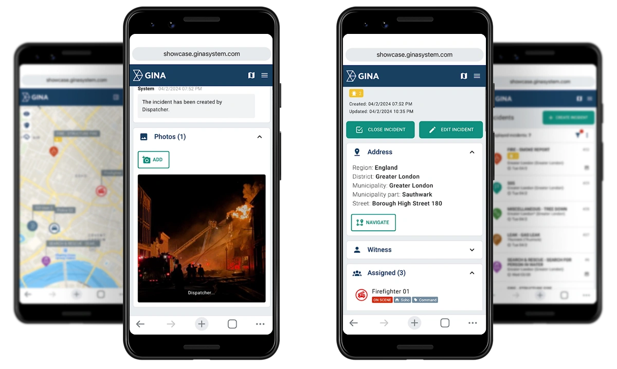
Stay fully informed with all the necessary information accessible on your phone.
Supervisor

Real-time incident data

Stay in control and well-informed by accessing the current details of active incidents.

Communication overview

Maintain visibility of team locations and statuses, as well as the current phase of the incident.

Multimedia archive

Review multimedia from incidents, providing a visual context for reports to the press and public.
Supervisor

Field responders

Stay updated on ongoing incidents and share information with other responding units.
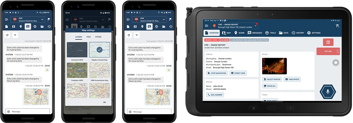
Quickly inform dispatchers about the status of the emergency situation.

Share and receive images and video from cooperating units.

Experience turn-by-turn navigation accounting for specific vehicle parameters, including exceptions for emergency vehicles.

See the locations of other units on the map for coordinated movement and support.

Visualize crucial points such as AEDs, hydrants, or other key locations on the map.

Access live CCTV, wearable, and mobile camera feeds directly from your device.

Highlight key areas and locations directly on the map, including color-coding, adding symbols, and notes.

Quickly access internal databases, such as evacuation plans and standard operating procedures.

Store witness contact information for follow-up.

Explore Smart CAD

Experience Smart CAD via an interactive demo. Get hands-on experience with its intuitive interface and see how it can streamline your emergency response workflow.

Intuitive interface

Intuitive interface

Fast deployment

Fast deployment

Smart solution

Smart solution

Monitor

Let's get in touch

Interested in knowing more about GINA? We are here to answer your questions. Drop us a line and one of our experts will get back to you.
We've got your message!

Our team is on it, and you can expect a response within 48 hours.

See how can our solution help you in your work. Read our blog