


AVL software plays a critical role in emergency response, where timing and clarity can mean the difference between success and failure. In unpredictable, high-risk environments, responders must make rapid decisions based on accurate, real-time information. Without this capability, even the best-trained teams risk delays, missteps, or exposure to unnecessary danger.
Among the most vital tools for enabling that clarity is the ability to know exactly where each team member is at all times. Whether coordinating a wildfire response, managing a complex search and rescue mission, or operating in law enforcement scenarios, real-time location awareness strengthens both team safety and mission control. GINA Tactical AVL software delivers dependable, real-time location sharing that empowers responders and ensures they remain protected and connected – no matter the terrain or tension.
Table of Contents
The Challenges in the Field
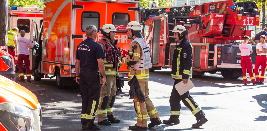
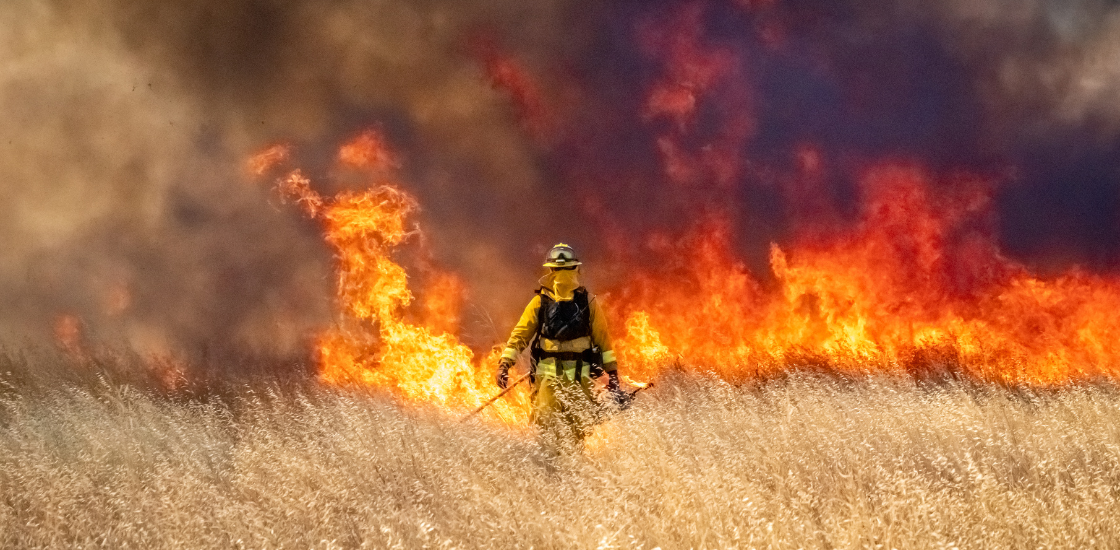
Emergency missions often take place in unpredictable and rapidly evolving environments. From dense forests to urban streets, responders face low visibility, shifting risks, and limited communication. In these conditions, even experienced teams can lose situational clarity.
Traditional communication methods – radio check-ins, verbal updates, or manual tracking – are often too slow or unreliable. Situational awareness can dissolve quickly, leading to confusion, delays, or worse, danger to life. The inability to accurately monitor movements and progress in real time makes it harder to make informed decisions and maintain a coherent operational picture.
The Importance of Real-Time Location Sharing
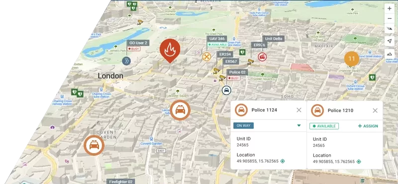
That’s where real-time location sharing becomes not just valuable – but vital. AVL software equips command teams with a live, map-based visualization of all personnel and assets in the field. This instantaneous visibility bridges the communication gaps that traditional methods leave open. It allows decision-makers to adapt quickly, make confident calls, and prevent overlap or misdirection.
With everyone connected through a shared visual platform, coordination becomes fluid and intuitive. Responders can focus on their tasks knowing they’re supported, monitored, and guided as needed. Command centers, in turn, can reroute teams, dispatch reinforcements, or isolate threats without delay.
Ultimately, AVL is not simply a tool for tracking. It is a platform for transformation – turning a collection of individuals into a synchronized, mission-driven unit. In the high-stakes world of emergency response, that transformation means faster reaction times, increased safety, and, most importantly, lives saved.
Behind every synchronized field operation is a foundation of intelligent mapping. More than just visual aids, these systems interpret live data, support strategic planning, and adapt as situations evolve.
Our article explores how mapping technology transforms real-time visibility into action.
How GINA Tactical AVL Enhances Field Operations
GINA Tactical AVL equips emergency services with precise, real-time oversight of personnel and vehicle movements – enhancing operational coordination, responder safety, and the speed of tactical decision-making. Key features include:
- Live Unit Tracking: Monitor real-time locations of vehicles and personnel, with movement history saved for later review – ensuring full situational awareness throughout every phase of the mission.
- Geofencing and Alerts: Define virtual boundaries and receive automatic alerts when units cross key zones, helping to proactively manage risk and maintain control.
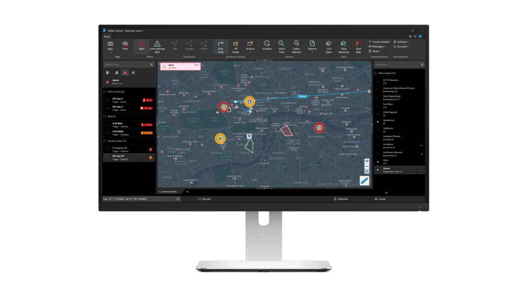
- Integrated Video and Sensors: Combine live camera feeds, sensor data, and field inputs into a single dashboard for a comprehensive operational view.
- Interactive Map Overlays: Visualize units and mission data on dynamic, up-to-date maps for quick interpretation and decisive action.
- Unified Command Dashboard: Access all alerts, location data, and video streams from one central platform, streamlining oversight and reducing information silos.
These capabilities provide real-time visibility and control, enable smarter coordination, and support safer, faster responses. After each mission, movement history can be reviewed for post-incident analysis – helping teams identify what worked, uncover gaps, and continuously improve.
Stay Ahead with Smarter Visibility
Protecting responders starts with knowing exactly where they are. GINA Tactical AVL delivers that clarity in real time, so you can lead with confidence, coordinate without delays, and respond more effectively when it matters most.
But location is just one part of the situational picture. Artificial intelligence is increasingly playing a pivotal role in analyzing data, predicting risk, and accelerating decision-making. Explore how AI is reshaping emergency management and what it means for the future of response coordination.
See how GINA Tactical AVL can elevate your response capabilities.
To explore our solutions in more detail, take a guided product tour of Tactical AVL or schedule a personalized demo with one of our product experts.